skip to main
|
skip to sidebar
George's Map Blog
Monday, April 19, 2010
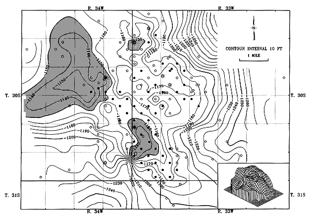
Isopatch Map
An Isopach map uses contour lines to measure the different thicknesses of rock. It is very useful to geologists. This map also has a three dimensional inlay to help understand the layout of the area.
No comments:
Post a Comment
Newer Post
Older Post
Home
Subscribe to:
Post Comments (Atom)
Followers
Blog Archive
▼
2010
(56)
▼
April
(44)
Star plot
Similarity Matrix
Histogram
Parallel coordinate graph
Triangular Plot
Windrose
Climograph
Box plot graph
Population Profile
Scatter Plot 2
Scatter Plot Graph
Index value plot
Lorenz Curve
Bilateral Graph
Ordinal point Map
Nominal point or line Map
Nominal Area Chloropleth map
Unstandardized Chloropleth Map
Unstandardized Chloropleth Map
Standardized chlorpleth Map
Bivariate Chloropleth map
Continuously variable proportional circle map
DOQQ map
DEM map
DLG Map
DRG Map
Isopleth Map
Isohyet Map
Isotach Map
Isopatch Map
Isobar Map
LIDAR
Doppler Radar
Black and White areal Map
Infrared Areal map
Cartogram
Flow map 2
Flow map 1
Proportional Circle Map 2
Proportional Circle Map 1
Chloropleth map 3
Chloropleth Map 2
Chloropleth map 1
Dot Distribution Map
►
March
(12)
About Me
George Witt
View my complete profile
No comments:
Post a Comment